API Launches Scanning Laser Tracker

31 May 2023 · < 1 min read

Who could you share this with?

API Launches Scanning Laser Tracker

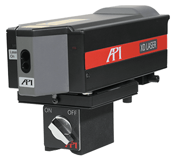
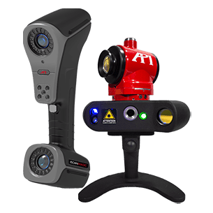
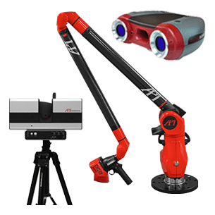
API Metrology announces the introduction of its RADIAN-Scan scanning laser tracker. The RADIAN-Scan is aimed at the 3D scanning and reverse engineering markets, offering a productive alternative to portable arms and hand-held, target-based photogrammetry scanning solutions.

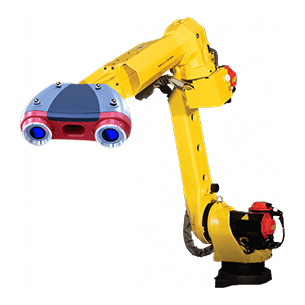
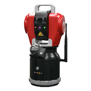
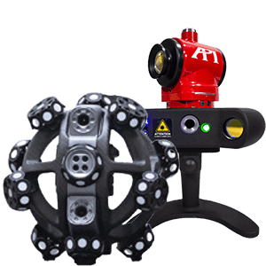
Integral to the RADIAN-Scan is API’s benchmark RADIAN PRO laser tracker, paired with the API iScan* hand-held laser-line scanner, offering a fast, accurate and ultra-productive solution to the generation of point clouds. Digitizing rates of up to 32,000 points/second are generated with the iScan sensor, capable of seamlessly scanning both reflective and dark surfaces.

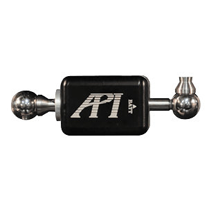
iScan features a 360o yaw and roll to achieve infinite sensor-tracked positioning. Simple one button operation initiates effortless scanning functionality. iScan* also offers a tactile probing interface, providing even greater measuring flexibility when scanning or measuring internal component features. iScan can perform part measurements as effectively as a traditional tactile coordinate measuring machine (CMM) with greater mobility and flexibilty. iScan probe features an internal battery, providing 6 hours of continuous use, easy grip handle, and tactile probing socket.

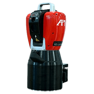
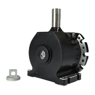
The RADIAN PRO laser tracker incorporates the compact and rigid UNIBODY tracker design which uses shaft-mounted motors, encoders and laser. The shaft-mounted laser minimizes ABBE offset errors and houses the laser source, optics, camera and major head electronics in the center of the tracker body, centering all heat sources and allowing rapid distribution of heat throughout the body during warm-up or drastic ambient temperature variations.

The UNIBODY design maintains thermal equilibrium through its operation due to a unique “Air-Over-Cooling” system, resulting in shorter warm-up times and superior measurement stability.

The RADIAN-Scan scanning laser tracker interfaces with any of the popular metrology point cloud software’s including Verisurf, Polyworks, and SpatialAnalyzer.

*Not available in Germany.

INTERESTED IN OUR METROLOGY PRODUCTS OR SERVICES? CONTACT US HERE.

radar vs lidar vs ladar

 – Radar

Radar (Radio Detection and Ranging) emits microwave pulses and measures the time for echoes to return. Because radio waves have long wavelengths, radar devices can detect objects at great distances and through fog, rain or dust. They are widely used in aviation, weather monitoring and speed‑enforcement. Radar systems provide a long range but lower spatial resolution compared with LiDAR . This lower resolution arises from the larger wavelength and beam divergence; as a result radar cannot pinpoint features smaller than several centimetres.

(source:wevolver.com)

 – LiDAR

LiDAR (Light Detection and Ranging) uses pulsed laser light to measure distance. Because it operates at optical wavelengths, LiDAR can produce very high‑resolution 3D point clouds. It is the backbone of autonomous vehicles and aerial mapping. LiDAR systems generally have a shorter to medium range but offer high spatial resolution, enabling detailed 3D mapping

LiDAR’s ability to capture millions of points quickly makes it ideal for applications such as autonomous driving and surveying. For manufacturing metrology, LiDAR is useful for creating digital twins of large objects or structures. However, typical LiDAR accuracy (millimetre to sub‑millimetre) is not sufficient for tight‑tolerance inspections that require micron‑level precision. Therefore, LiDAR still falls short for high‑precision metrology in aerospace and automotive manufacturing.

– Laser Radar

Laser radar is often used to describe high‑precision laser time‑of‑flight systems. It uses a narrow, focused laser beam and measures not only the time of flight but also the angles of the incoming beam to compute precise coordinates. Laser radar systems can achieve micron‑level precision but typically operate over shorter ranges and at slower scanning speeds compared with LiDAR. Laser radar system steers a focused beam, reading the return signal directly from the object without a retroreflector, and is engineered to provide precise, industrial measurements with tolerances of thousandths or even tenths of thousandths of an inch. However, the speed of data collection is sacrificed for resolution—laser radar scans smaller areas more slowly to achieve high accuracy

(source:eastcoastmetrology.com)

– LADAR (Dynamic 9D LADAR by API)

LADAR (Laser Detection And Ranging) is sometimes used interchangeably with LiDAR, but API’s Dynamic 9D LADAR is a novel system that blends interferometry with laser scanning. LADAR is an interferometry‑based non‑contact measurement system that provides fast and accurate data acquisition. It overcomes several limitations of conventional measurement methods by delivering micron‑level resolution and eliminating issues such as limited accuracy, slow data acquisition speeds and sensitivity to surface reflectivity. LADAR technology uses fast data acquisition to deliver rapid, real‑time data collection, significantly reducing measurement and analysis time compared with traditional methods. It also functions effectively in noisy production environments and at various incident angles. The technology delivers rapid, real‑time data collection, making it suitable for in‑line production measurements where conventional laser radar is too slow.

To learn more about how LADAR can preform in line inspection, click here.

Know anyone who would value reading this article too?
Why not share it with them!

Featured API Metrology Videos

Got
Questions?

Our Expert team of Real Metrologists are Globally-Local, available for measurements both at your site and in our A2LA accredited calibration labs. They can assist with everything from equipment purchases and rentals to customer support to contract service work.